The interactive map of the White Clay Creek watershed uses ArcGIS files to display open space, monitoring sites, riparian buffer gaps, and other attributes of the watershed. Each layer can be turned on or off, depending on your interest. Links are embedded into the pop-up window for each attribute where you can get more information including live water quality data. Please contact mpc@whiteclay.org if you have any questions. Link to map.
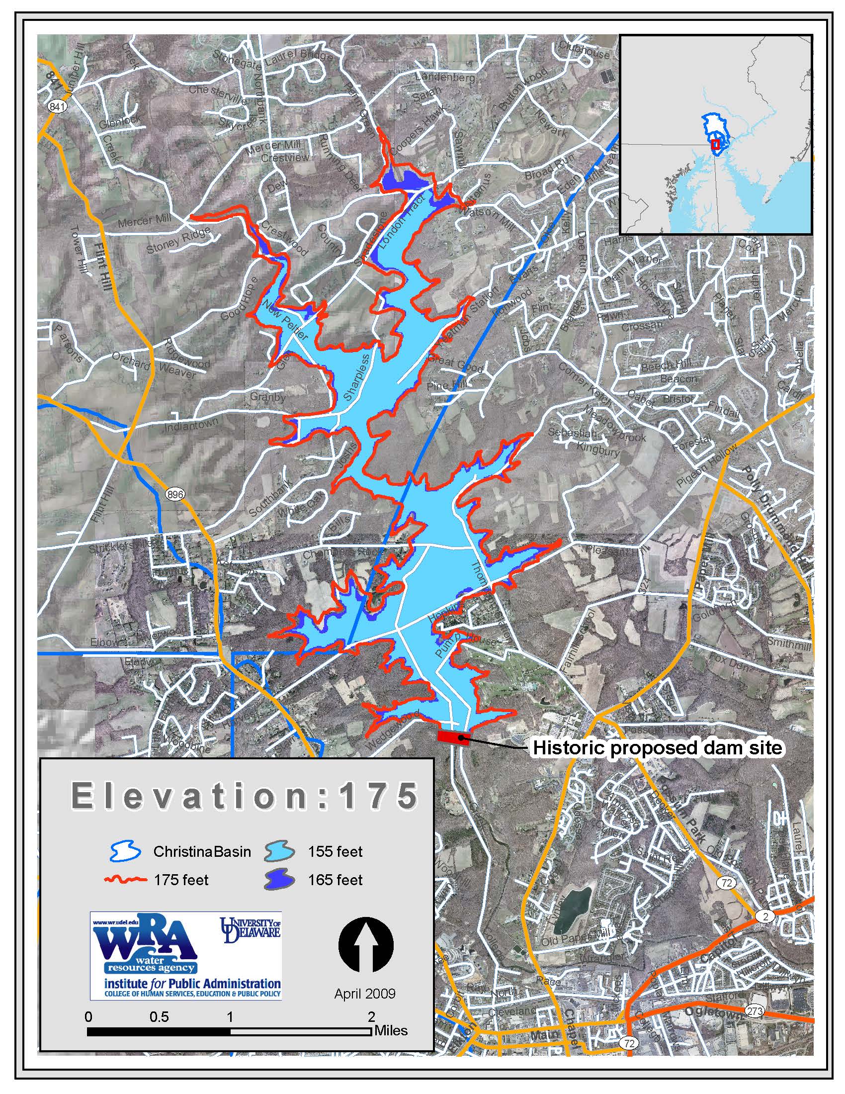
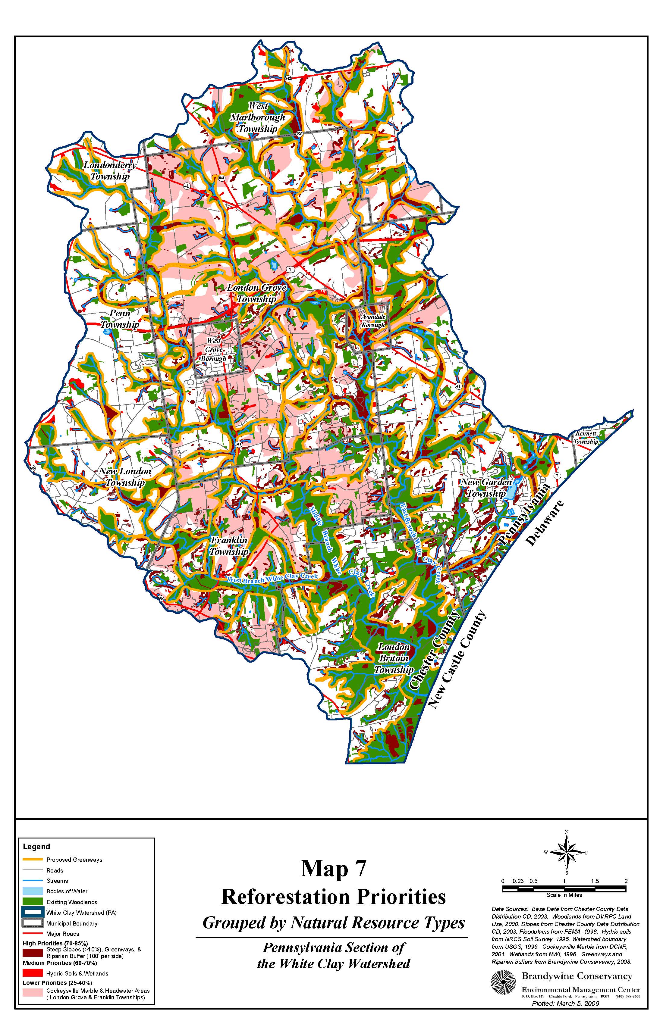
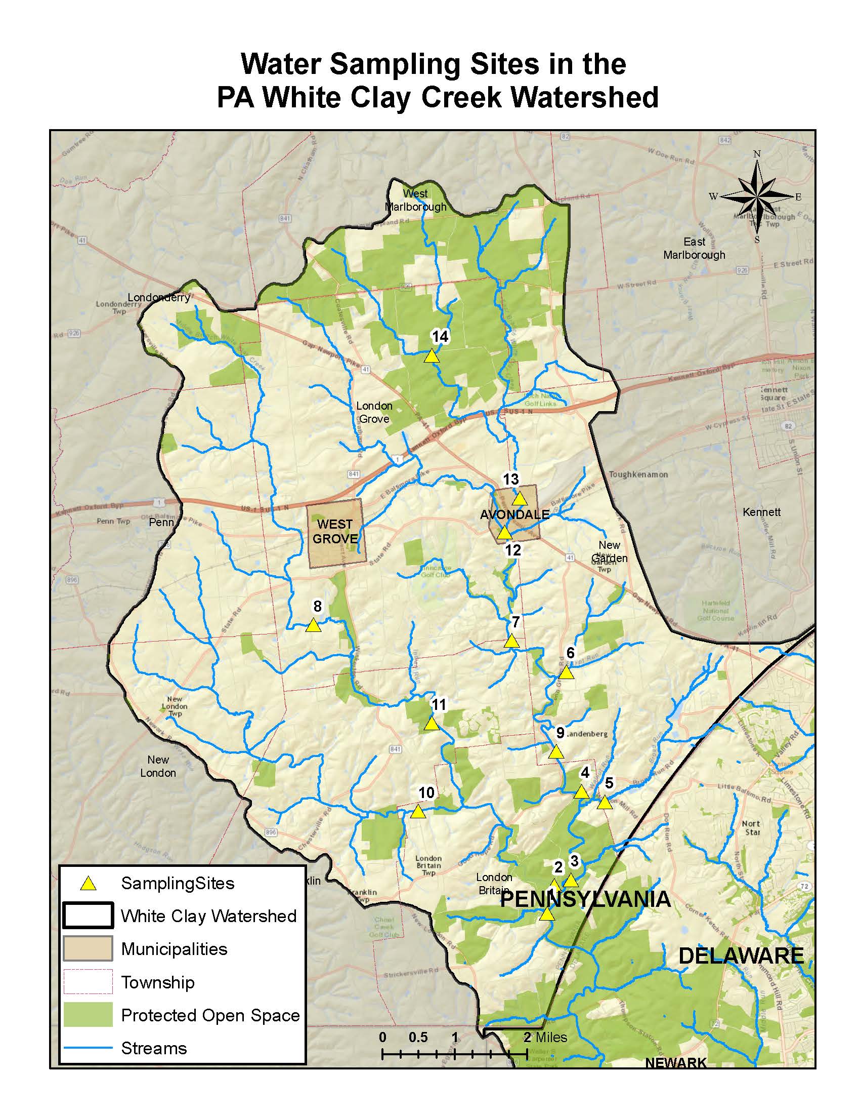
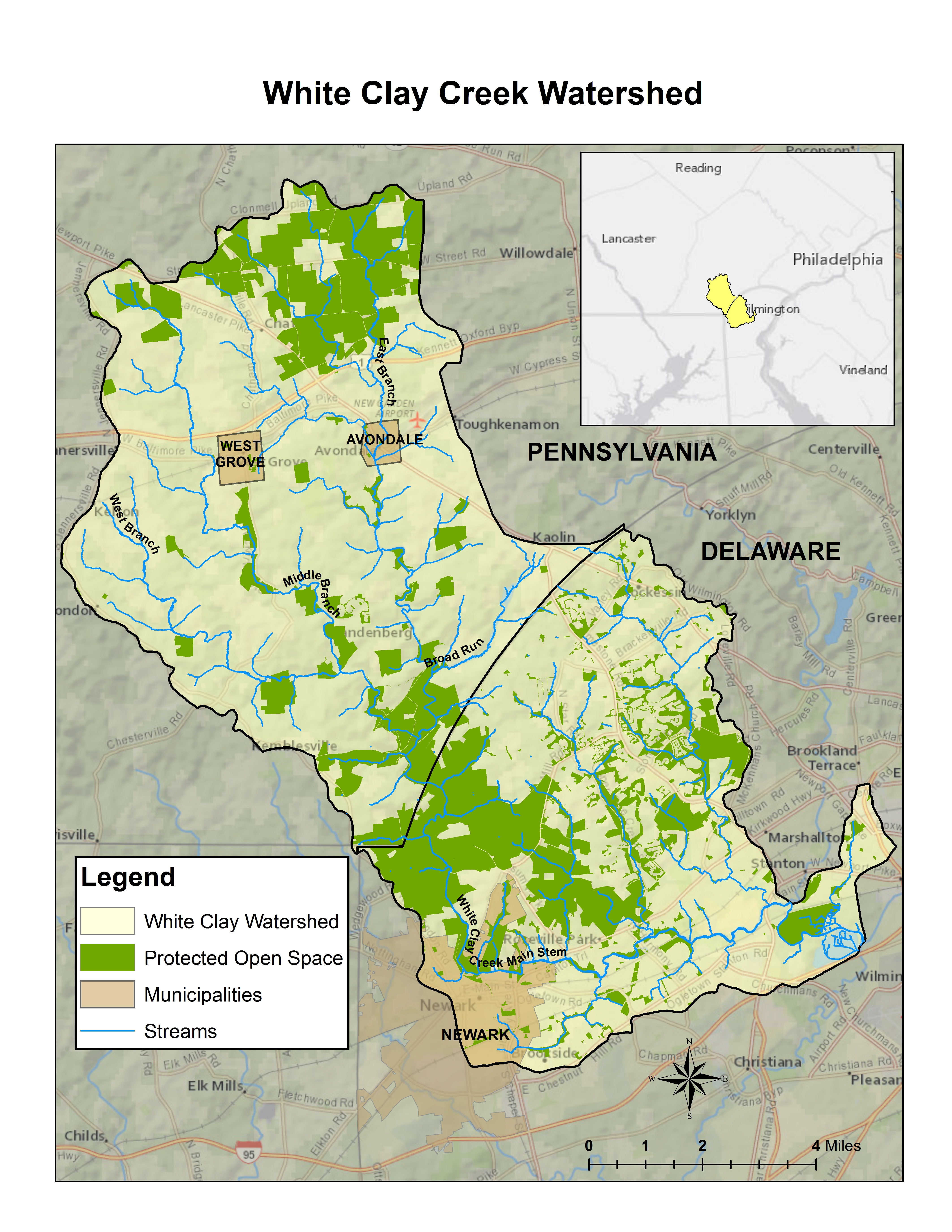
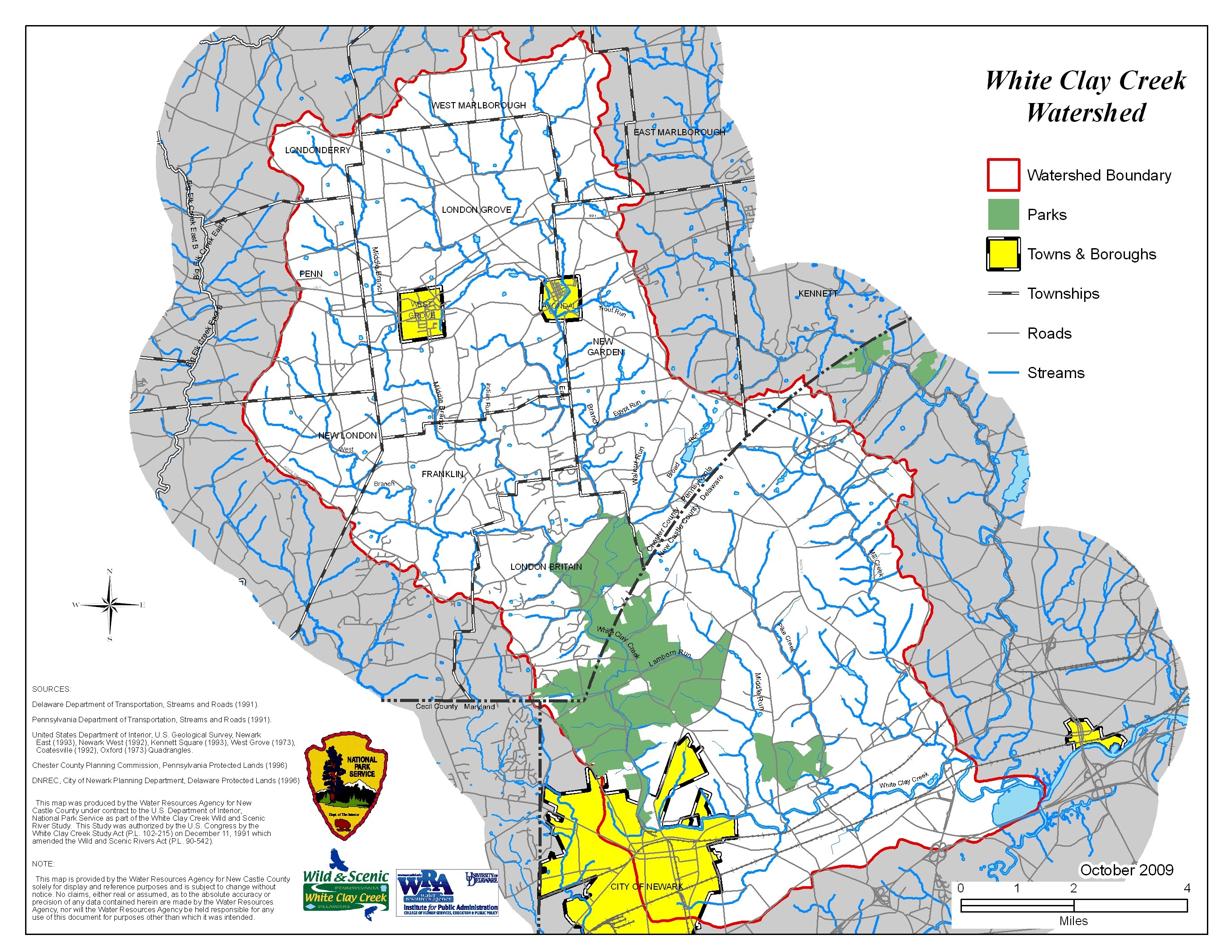
General Watershed Maps
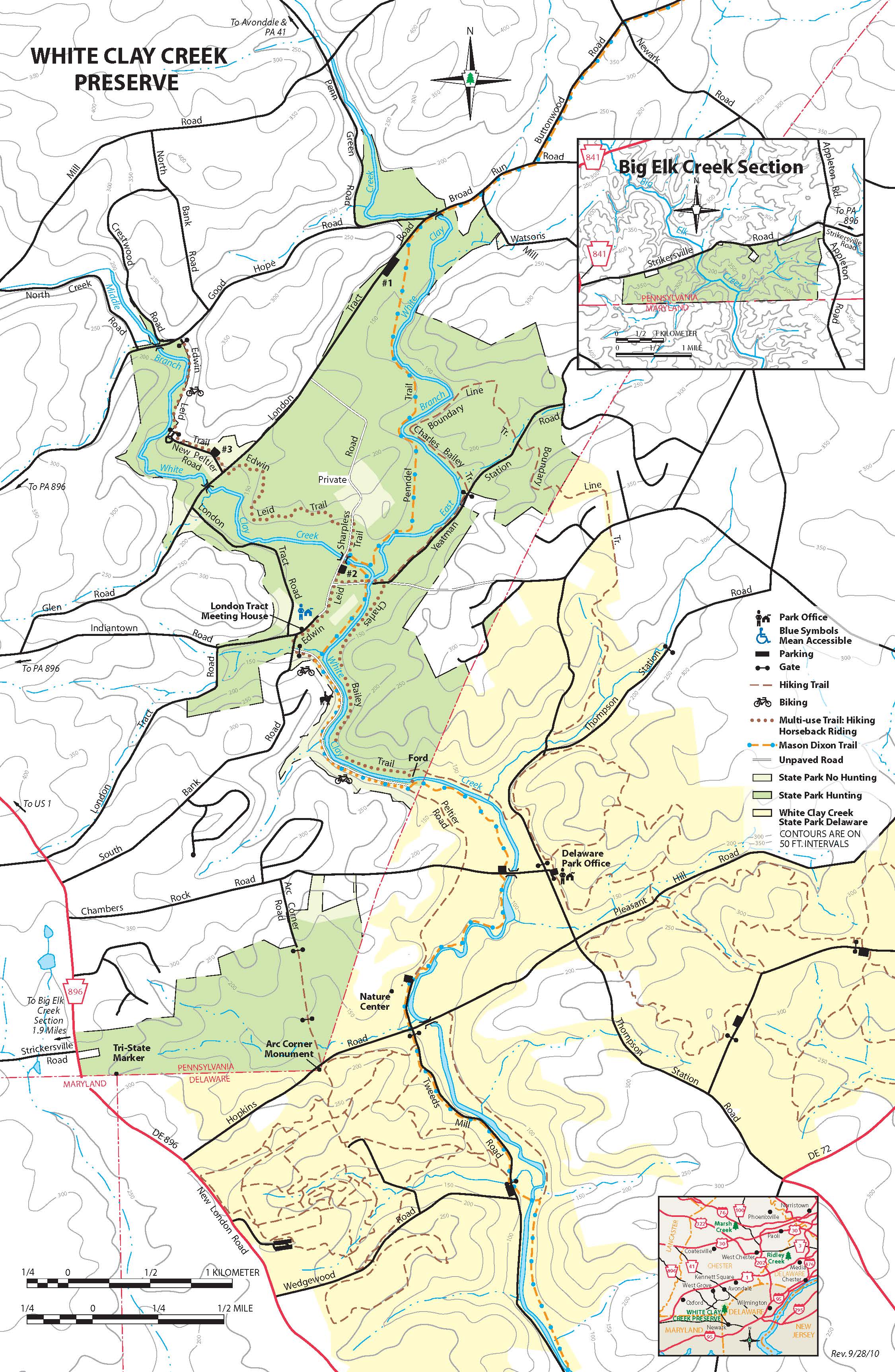
wild and scenic maps


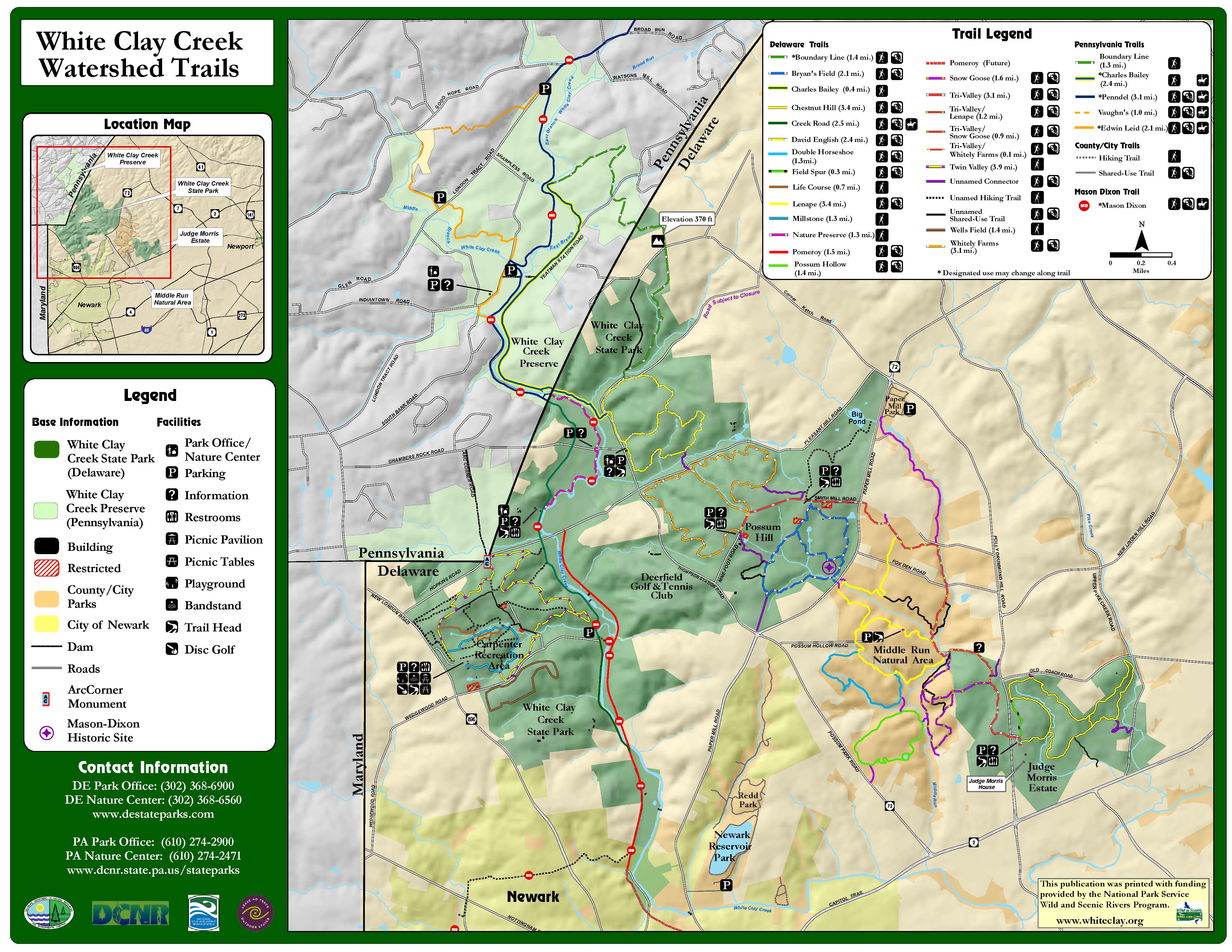
Trail Maps
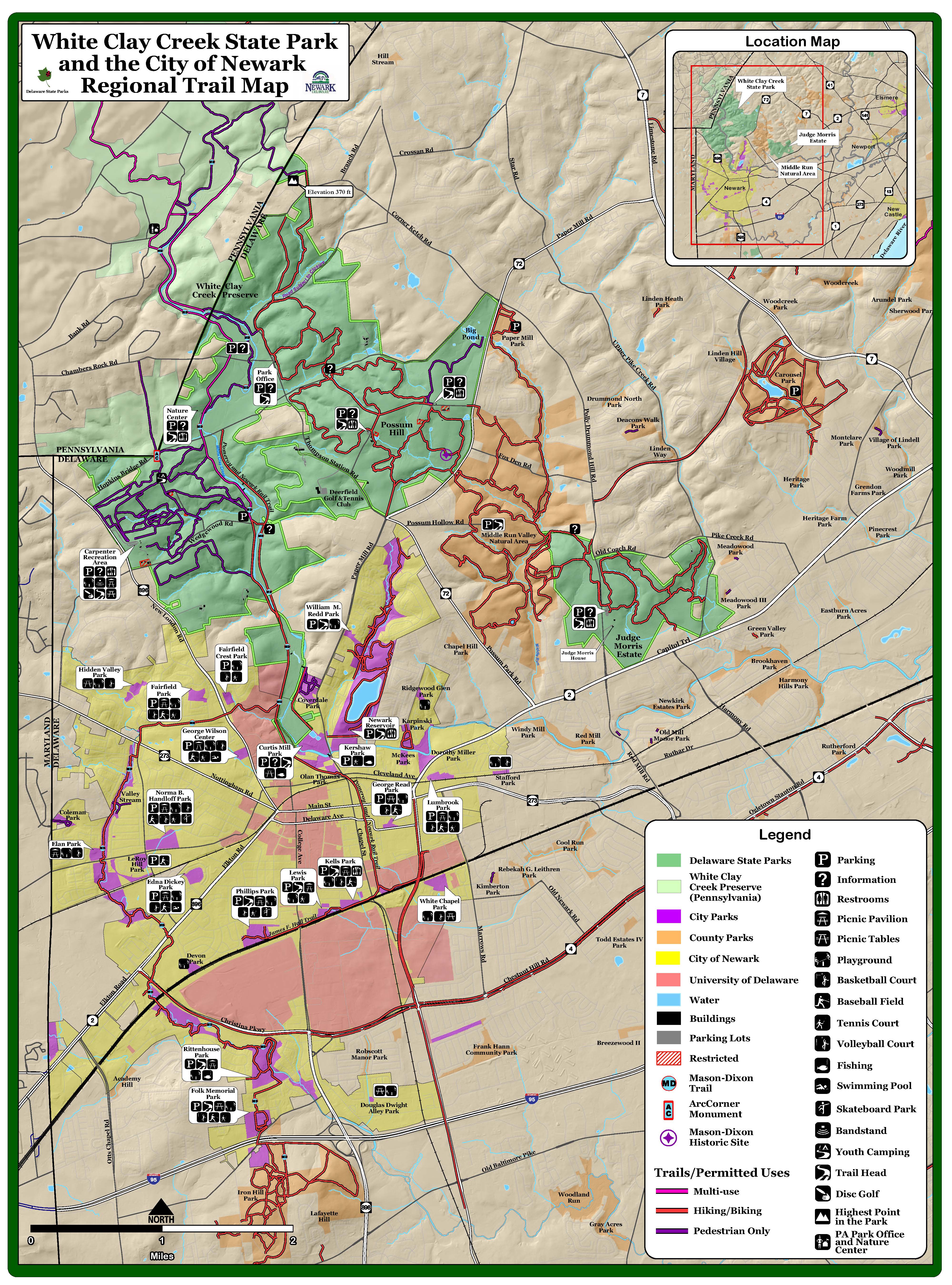
miscellaneous maps